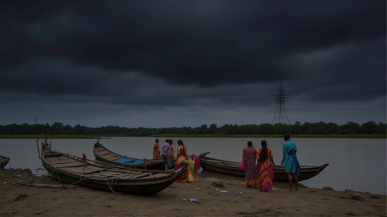
When India Meteorological Department (IMD) released a weather warning on October 2, 2025, residents of West Bengal braced for days of heavy rainfall that could push the region into flooding mode. The alert, which covers the entire state through October 6, cites a fresh Western DisturbanceNorthwest India as the chief driver of the deluge. Officials warn that water‑logging, localized floods and snarled traffic are likely, especially in low‑lying districts.
Forecast Overview
The IMD’s October 2 bulletin paints a picture of sustained moisture influx from both the Arabian Sea and the Bay of Bengal. The system is expected to reach its apex on October 6, when the agency predicts “heavy to very heavy” precipitation across the sub‑Himalayan belt. In practical terms, that means isolated downpours of 50‑80 mm in a single day, with hailstorms flashing over the hills.
Temperatures will cling to a narrow band of 25 °C to 32 °C (77 °F‑89 °F) for the whole month, making the humidity feel even more oppressive. The department projects a total October rainfall of about 153 mm for the state, spread over roughly seven rainy days. That’s nearly a third of the average monthly total, and well above the 24 dry days usually recorded.
Recent Weather Events
Just before the latest warning, a deep depression slunk across the Bay of Bengal, slamming the coastal strip of Gopalpur with gusts that topped 73 km/h on the evening of October 2. The wind ripped up trees and tossed loose roofs, while rain hammered the town for hours.
Neighbouring Odisha logged “extremely heavy” rainfall at isolated spots, and coastal Andhra Pradesh reported similar intensity. Those rainfalls were not isolated anomalies; they were a pre‑lude to the broader Western Disturbance that now steers the weather over the eastern seaboard.

Impacts on Communities
In the state capital, Kolkata, commuters are already hearing the rumble of traffic snarls as water pools on arterial roads. Local shop owners say they’ve stocked up on sandbags, fearing that even a few hours of “very heavy” rain could flood basements and stall small businesses.
Up north, the city of Siliguri faces a different headache. The forecast shows temperature swings that could trigger fog‑driven accidents on the hill‑top highways. Residents there have expressed worries about landslides, especially in the tea‑garden valleys that dot the region.
In the sub‑Himalayan districts and the state of Sikkim, the rain will be lighter—mostly “light to moderate” with occasional thunderstorms. Still, authorities note that even modest rain on saturated soils can trigger flash floods in the narrow river valleys.
Farmers across the Gangetic plain of West Bengal are caught between two extremes: too much rain could wash away seedlings, while a sudden dry spell later in the month could scorch already stressed crops. The IMD’s advisory urges them to secure storage for harvested produce and to monitor soil moisture levels closely.
Expert and Authority Responses
Dr. Rohit Banerjee, senior climatologist at the Calcutta Climate Research Institute, told reporters, “The convergence of Arabian Sea moisture with the Bay of Bengal’s plume is a textbook recipe for prolonged rain events. What makes this situation tricky is the timing—October is already a transition month, and the added Western Disturbance pushes the system past the usual thresholds.”
Meanwhile, the State Disaster Management Authority (SDMA) has dispatched rapid‑response teams to districts identified as flood‑prone. In a brief statement, the authority said, “We are coordinating with local panchayats to clear drainage channels and pre‑position sandbags where needed. Residents should stay alert for real‑time updates on our official portal.”
Local resident Sunita Devi from Barasat shared her worries: “Last year the rain came early and we got stuck for days. This time we have a forecast, but the streets still flood quickly. I’ve told my neighbours to keep something waterproof handy.”

Looking Ahead: October Outlook
Beyond October 6, the IMD expects the Western Disturbance to weaken as it moves further west. However, the moisture reservoir over the Bay of Bengal remains high, meaning occasional showers may linger into early November. The department advises that shoppers postpone major outdoor events until after the 7th, when the likelihood of “very heavy” rain drops to under 20 %.
In the longer term, climate analysts point to a rising trend in October rainfalls across eastern India. A recent study by the Indian Institute of Tropical Meteorology noted a 12 % increase in October precipitation over the past three decades, correlating with broader monsoon variability driven by sea‑surface temperature shifts.
For now, the message is clear: stay prepared, keep an eye on local alerts, and understand that the next few days could test the resilience of West Bengal’s infrastructure and its people.
Frequently Asked Questions
How will the heavy rainfall affect daily commuters in Kolkata?
Roads in Kolkata are likely to see water‑logging, especially along the Hooghly River banks. Public transport may run on altered schedules, and commuters are urged to allow extra travel time and keep emergency kits in their vehicles.
What precautions are authorities taking in flood‑prone districts?
The State Disaster Management Authority has pre‑positioned sandbags, cleared key drainage channels, and set up temporary shelters. Local police are monitoring traffic bottlenecks, while health teams stand ready for any water‑borne disease outbreaks.
Why is the Western Disturbance causing such intense rain this year?
This year's disturbance is drawing moisture from both the Arabian Sea and the Bay of Bengal, a dual‑feed that amplifies precipitation. Coupled with an upper‑air cyclonic circulation over Arunachal Pradesh, the system has more lift to generate heavy to very heavy rain.
What does the forecast mean for farmers in the Gangetic plains?
Excess rain can damage seedlings and cause soil erosion, but it also replenishes groundwater. Experts recommend using raised beds, securing stored produce, and monitoring soil moisture to avoid both flooding and later drought stress.
Will the rainfall pattern continue beyond October 6?
The IMD expects the Western Disturbance to weaken after October 6, but lingering moisture over the Bay of Bengal means occasional showers could persist into early November. Residents should stay tuned to updates for any new advisories.


